Tangier City and Bay
When Lord Dartmouth evacuated Tangier he had orders to ensure the port could not be used by England's rivals. The harbour mole was to be destroyed, the city walls demolished and all the houses knocked down.
Insert ‘Tangier in its Ruins'
So if the city was razed to the ground what can the present day visitor find of English Tangier?
How can we envisage what the place was like under English occupation?
The task of destruction was not an easy one - the gunpowder provided was soon found to be inadequate; almost all of it was needed to render the mole ineffective, and most of the demolition of the town was carried out by soldiers with picks and shovels.

Perhaps surprisingly modern day Tangier can give us a very good idea of the ‘feel' of English Tangier.
It is true that the mole was not re-constructed, but the destruction of the city was no-where near as complete as the occupiers would have liked. Sheik Ismail had much of the city rebuilt pretty-well as it had been before the English destroyed it.
For a start, the city walls were largely rebuilt in the same position as the previous walls.
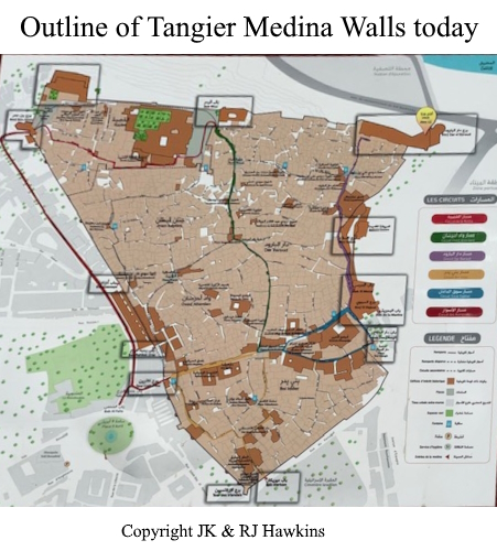
Thus the walled area of the Medina or ‘Old City' quarter of modern Tangier is almost exactly the same as it was in the time of English Tangier.
The two main gates of the Medina are in the same location as in English Tangier, and the layout of the streets is almost identical to that shown on C17th maps.
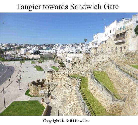
The seaward gate, previously Sandwich Gate, now Bab el Marsa (the Harbour Gate) still stands at the top of what was Queen's Steps; one of the land gates is in the same position as St Katherine's Gate previously stood – these two gates are joined by the same roads as before, Rue de la Misericordia (now Rue de la Marine), the Market Place (Place Souk Dakhel) and St Catherine's Street (Rue Siaghine).
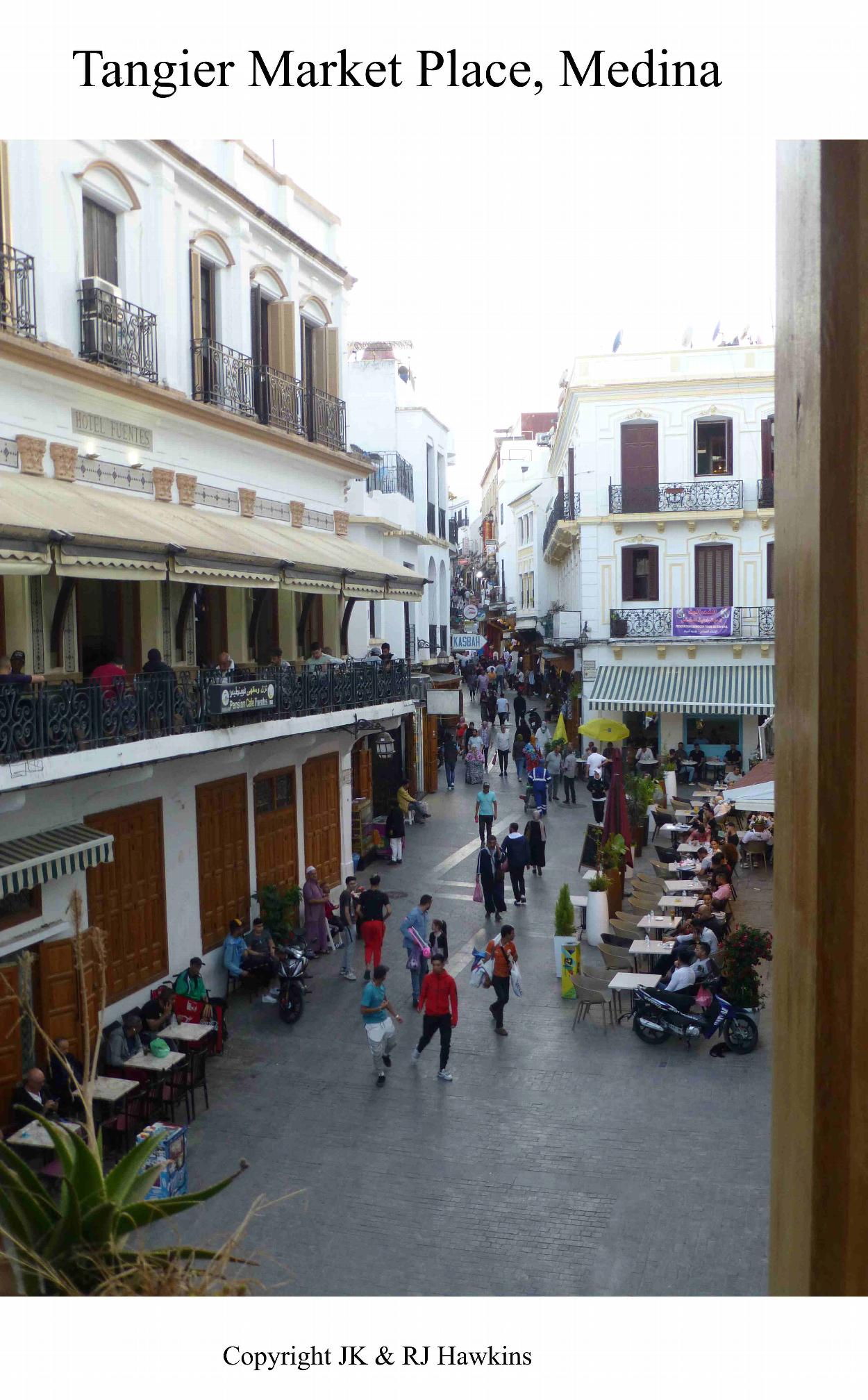
Part of the Market Square remains, though much of it has been built on, but it is still something of a hub, and a night-time visit, particularly to the rooftop restaurants rewards you with a vibrant atmosphere and great views.
Although there is no access onto the ramparts themselves the modern day explorer can walk almost the whole circuit of the city walls by following roads outside the Medina. The bastions have been rebuilt, marking each corner of the city.

Irish Battery is still called Tower of the Irish, Katerina Gate though lacking its ravelin and outer defences is graced by Catherine Tower, the S.E. Tower is now Borj Ben Amar, the batteries of the Citadel (now the Kasbah) are rebuilt and renamed and James' Castle is replaced by Borj al Baroud – which houses a museum well worth a visit.
The most significant difference from C17th Tangier is the sprawling metropolis outside the Medina which makes it very difficult to get any idea of the hinterland of English Tangier. Nonetheless the bay remains with the port jetties giving an idea of what the mole might have been like, and the curve of the coastline around past Old Tangier to the headland must be very similar.
More detail can be found in Elbl, M.M., Portuguese Tangier (Baywolf Press), and admirably detailed, if somewhat biased against the English, analysis of the history of the walls and bastions of Tangier.